
River Bollin Pollution Journal
December 2021 to Date
| Home | Report a Problem | Pollution Journal | Sewers & Drains | Our Sewage Works | Farm Run-Off | Invasive Species | How to Help | Who's Involved | River Facts | River Jargon |
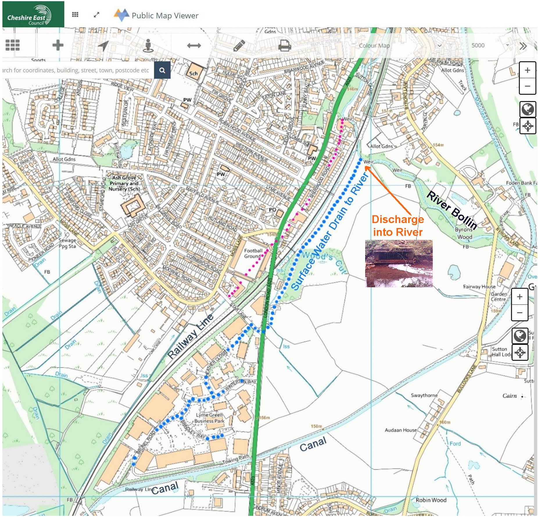
The principal area of concern is a surface water drain, not a combined sewer overflow, serving Star Lane and the Lyme Green Trading Estate.

-
On the map below, the blue dotted line shows the course of the drain into the river.
-
Note how the railway line, running in a deep cutting, has blocked any drainage from flowing south-eastwards into Star Lane.
-
Also, the car washes south of the canal were not involved; their surface water flows directly into the canal.
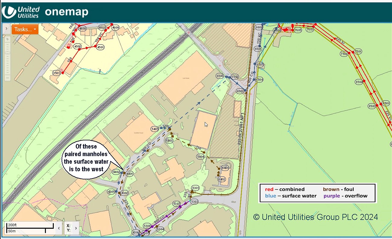
The United Utilities mapping shows the surface water drain as a blue dashed line with a series of diagnostic manhole covers:-
The events below are in reverse order;
most recent
first.
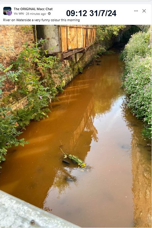
Brown water seen beside Victoria Mill, off Windmill Street,
The Environment Agency Ref 2292167.
This has similarities to events in May 2024 and June 2023.
Friday 03 May 2024
Environment Agency Reference: 2264460
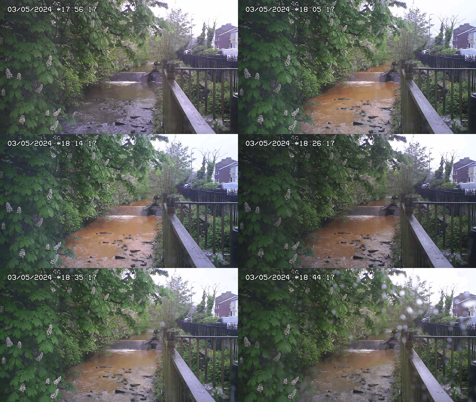
| Note: the water colour is similar to that which entered the river from the problematic surface water drain on 9 June 2023. |
 |
Thursday 07 March 2024
First Reported around 1 pm from the bridge on Sutton Close, SK11 7RW, in the south of Macclesfield.
The Environment Agency were on site before 2:45 and attended the pollution incident across three days (7-9 March), to assess the impact on the river Bollin and attempt to trace the pollution, but unfortunately on this occasion were unable to locate a source.

The Point of Entry was the same surface water drain as in the February 2023 episode (not a sewer overflow).
Once again, the Environment Agency traced the foam south along the blue dotted surface water drain to Star Lane, but the agency were unable to identify the precise source.


Old Mill Lane Weir


Friday 09 June 2023
What appears to be iron oxide, possibly from back-flushing a water
filter,
on
Friday June 9 2023:-

If there had been prior occurrences, it could account for
the staining of the river bed seen months
earlier:-
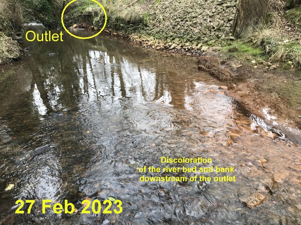
Wed 22 February - Mon 20 March 2023

The Environment Agency say that over a thousand fish were killed in this foam episode from 22nd of February 2023. (EA Ref: 02132393) and it was followed by a series of discharges until 20th March 2023.
The point of entry to the river was located, and time-lapse photography showed that the problem (on a smaller scale) continued throughout March, and was worse during weekdays.
The agency visited businesses ascertaining, the nature of the business, the types of products used or produced, and where appropriate, had further discussions regarding waste disposal arrangements.
In partnership with United Utilities, a number of drains were dye tested which resulted in two
misconnections being identified where wastewater from car washing at two
dealerships meant for foul drains had been connected
to surface water, and an instance of poor site practise whereby wastewater
intended for the foul sewer could reach surface water drains.
The EA directed corrective action, and that seems to have cured the
day to day foam shown below from March 1st - 20th,

But this was not the end of the matter, as heavy foam build-up recurred a year later in March 2024 (see above).
The above picture is a frame taken from two time-lapse videos Video 1 and Video2, you can use the gear icon to slow down the frame-rate and/or you can view selected frames shown below the videos.
May 2022
|
The above February 2023 foam episode had lots of similarities with this Incident on 11th May 2022 at Old Mill Lane Weir. Environment Agency Incident No 2062906 |
 |
December 2021
| Adjacent to
Beech Farm Drive 21-23 December 2021 including 1350Hrs 23/12/21 Video clip |
 |
If you want to trace pollution upstream, this map shows places where
the river can be observed from the roads in red, and CSOs in yellow.

 |
Get this map on your phone |